
- Costa Rica
- Costa Ballena
- Tours & activities
- CAMINO AL AEROPUERTO
Tours & activities
Shops & services
CAMINO AL AEROPUERTO
Costa Ballena, Costa Rica

About CAMINO AL AEROPUERTO
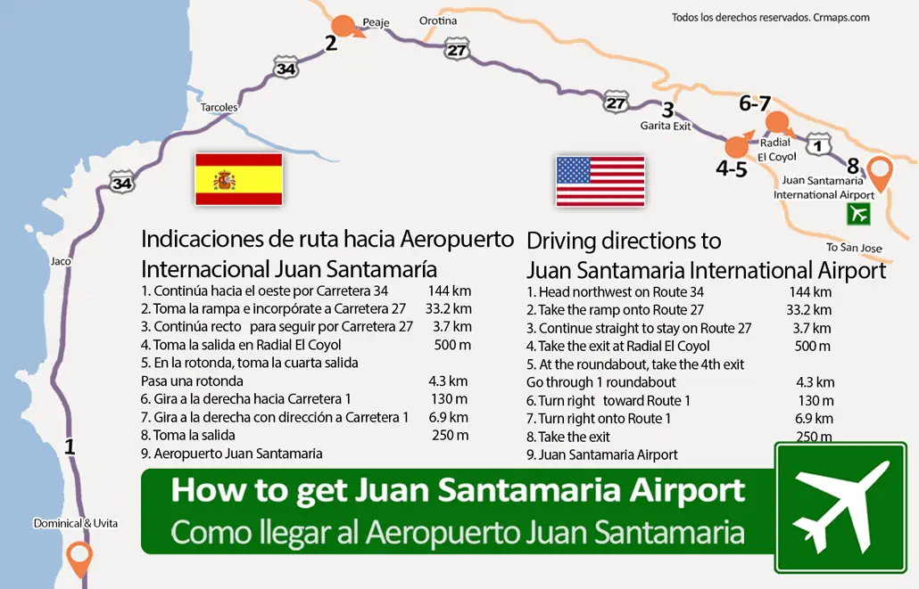
The driving route from Costa Ballena (starting from Uvita) to Juan Santamaría International Airport (SJO) is approximately 207 kilometers (128 miles) and takes about 3 hours and 30 minutes under normal traffic conditions. It is a scenic drive that spans almost the entire Costa Rican Pacific coast before ascending to the Central Valley.
Location
RegionCosta Ballena, Costa Rica
Coordinates9.998563, -84.204157