
- Costa Rica
- Manuel Antonio & Quepos
- Tours & activities
- CAMINO AL AEROPUERTO
Tours & activities
Shops & services
CAMINO AL AEROPUERTO
Manuel Antonio & Quepos, Costa Rica

About CAMINO AL AEROPUERTO
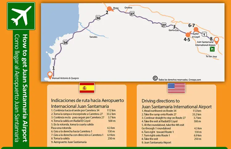
The driving route from Manuel Antonio National Park to Juan Santamaría International Airport (SJO) is approximately 156 kilometers (97 miles) and takes about 2 hours and 45 minutes under normal traffic conditions. The main route borders the beautiful Pacific coastline before ascending toward the Central Valley through highly efficient highways
Location
RegionManuel Antonio & Quepos, Costa Rica
Coordinates9.998563, -84.204157